
May 12 - Sea to Sky Snow Conditions
Overall theme:
Temps were seasonal - briefly… Now we return to summer! We’ve had a short period of temps in the seasonable range but now we’re facing another heat-dome. This will make finding good skiing challenging!
Where we’ve been skiing:
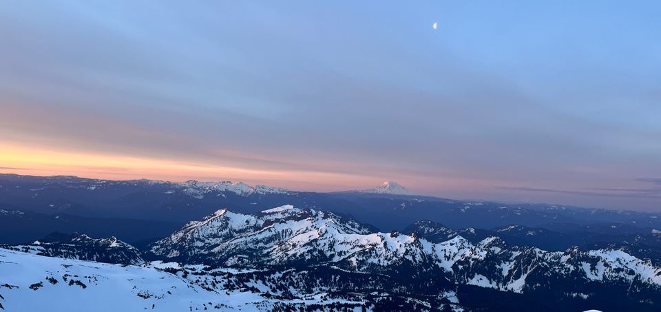
Eric took advantage of the clearing sky and cooler nights for a quick volcano tour skiing on Kulshan and Tahoma (Baker and Rainier). Evan had his tour of the North Cascades the previous week and is off to Mexico!
What’s happened since the last update (weather & general snowpack structure):
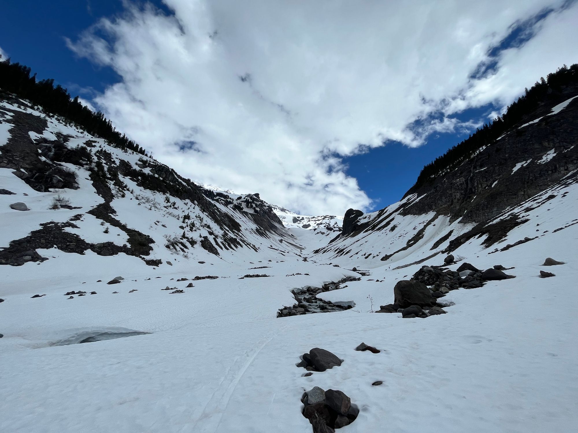
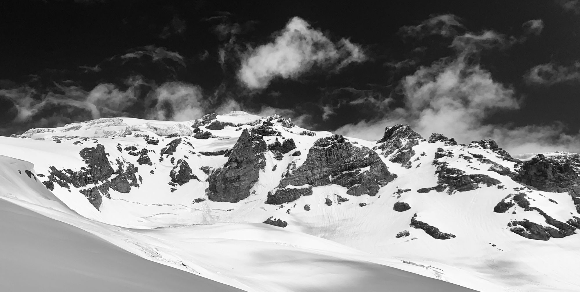
In the Cascades, conditions were generally spring diurnal meaning that temps dropped below freezing at night with clear skies and then warmed up significantly during the day creating a freeze-thaw cycle on the snowpack. There were small pulses of precip on Monday and Wednesday afternoons, likely caused by convective showers, and accompanied by thunderstorms, that help improve ski conditions slightly. Both mountains, above 2,500m showed evidence of a lingering winter snowpack up high. We spotted numerous old slab failures on Mt. Baker. On Rainier we noticed several somewhat recent size 2.5 - 3 slab avalanches above 3,000m. Loose wet avalanches were happening in the afternoon in steep terrain and we triggered one fairly large size 2 from seemingly innocuous terrain that picked up a lot of bulk as it slid.
What’s the weather and avalanche forecast?
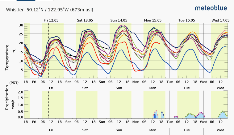
We have a high pressure ridge building over the South Coast meaning it’s going to be very warm and dry through monday at least! As you can see in the MeteoBlue forecast below, Whistler could see daytime highs near 30 degrees on Sunday! Overnight lows will still be in the mid-teens so we’ll see what that means in the alpine but I don’t expect great overnight freezes. If you get out Sunday or Monday, go early and look for simple terrain! This will certainly cause significant snowpack loss and we’ll also see big bumps in streamflow.
Avalanche Canada has stopped their forecasts for the season and are now displaying their spring avalanche conditions information. This is great info and it’s well worth keeping in mind that some mornings we may see low avalanche hazard in the AM, increasing to high hazard in the PM while other mornings with minimal freeze, we may see elevated hazard throughout the day! There is still the possibility for a return to cooler May weather later in the week and a possibility for more “wintery” avalanche conditions on very high peaks.
Remember that even with AvCan no longer providing an avalanche forecast for the season, they still produce their mountain weather forecast. This is an amazing resource for planning those adventures this time of year.
What are my questions for the weekend?
Where can I find good, easy to access snow this weekend? This is probably going to be tricky. Any low-elevation snow is melting out fast and likely not re-freezing. All the low-elevation trailheads will require a bit of walking to reach snowline. The reality is, it’s starting to be late spring/summer conditions and we need to adjust our ski plans accordingly. Here’s a few thoughts:
- Cascade Volcanos:
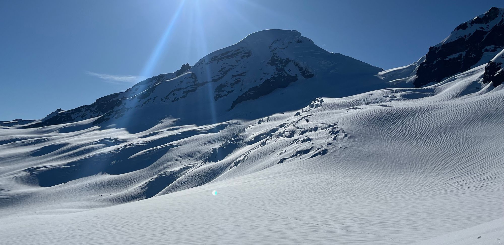
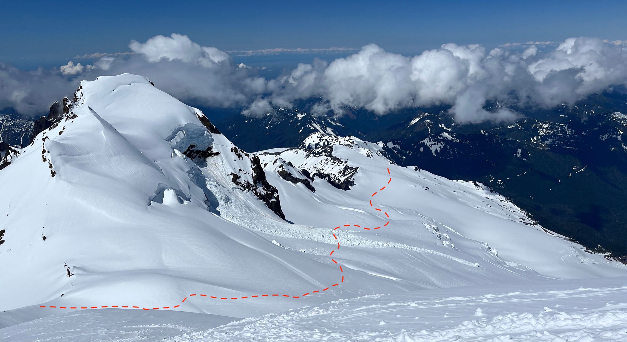
- Mt. Baker: access on the Heliotripe Ridge TH is still complicated by a washout. Parking is currently at ~500m just after crossing the bridge over Glacier Creek. This is approx 8km (and 670m+) of road walking to the TH (e-bikes are the ticket!). Mid-week, the snowline was about 4k from the trail head for continuously skinnable snow with the TH completely snowed in and Grouse Creek winter route fully skiable. This may change over the next week and the route may shift to the normal summer trail. The upper mountain is in good shape with no major crevasse crossings on the Coleman-Demming or Roman Wall. There was a significant serac avalanche off Colfax Peak that obliterated a portion of the normal route. Move quick under the seracs! Rumor from the south side is a bit of walking is required to reach snowline from the TH.
- Mt Rainier: Lots of snow at Paradise makes for easy skiing from the car. All normal routes are in great shape and glacier coverage is quite good with minimal crevasse difficulty. This week it was still totally reasonable to ski to the Nisqually Bridge but that may change.
- Mt Hood: Reports sound like plenty of snow and good conditions!
- California and the High Sierras: No firsthand info but rumor is that Mammoth is still shoveling out from their last storm and Tahoe is generally inundated with snow. I would imagine that skiing in the Mammoth or Bishop area would be epic.
- Canadian Rockies and Roger’s Pass: Suffering a similar fate to the South Coast. Very warm and losing snow fast. If you catch the Pass with good seasonable temps and overnight freeze, you’ll probably be in luck. The Rockies have been so dry all season, it’s hard to imagine amazing conditions. The Icefields Parkway and Robson areas all sound to have minimal snow coverage and hot temps in the forecast.
What will I watch out for or avoid completely?
- Afternoon warming and thunderstorms! We don’t often get PM storms but they could happen with these conditions building, especially early in the week.
- Of course, loose wet avalanches should be a big concern in the afternoons. If the snowpack feels mushy all the way through, probably best not to be on it!
- Slip and fall hazard! This is deserving of a longer discussion but with melt-feeze conditions, you get very firm and icy snow surfaces in the morning. A slip and fall can happen and have serious consequences! Ski crampons are massive for both safety and for conserving energy. Choose your timing for descents wisely and if needed, wait for the surface to soften.
Closing Thoughts:
I’m not ready to hang up the skis yet. If I was totally unencumbered, I think the Sierra’s would be my first choice. I have to make due with shorter windows so I’ll be watching freezing levels and thunderstorm risk on the Cascade Volcanos for now and perhaps the occasional corn mission here in the Sea-to-Sky. Looking further afield, the Alps seem to be winding down their spring season as well but New Zealand is just starting to open up their resorts. The truly dedicated could head that direction!
Eric Carter and Evan Stevens contributed to this report. For more information, check out Zenith Mountain Guides and our local avalanche forecast. This update is supported by SkiUphill Squamish - the best stop for ski touring equipment in the Coast Mountains!
Use this information at your own risk! We are not responsible for your actions in the backcountry and things change rapidly from when this report was written!
Member discussion