
Mar 3 - Sea to Sky Snow Conditions
Overall theme:
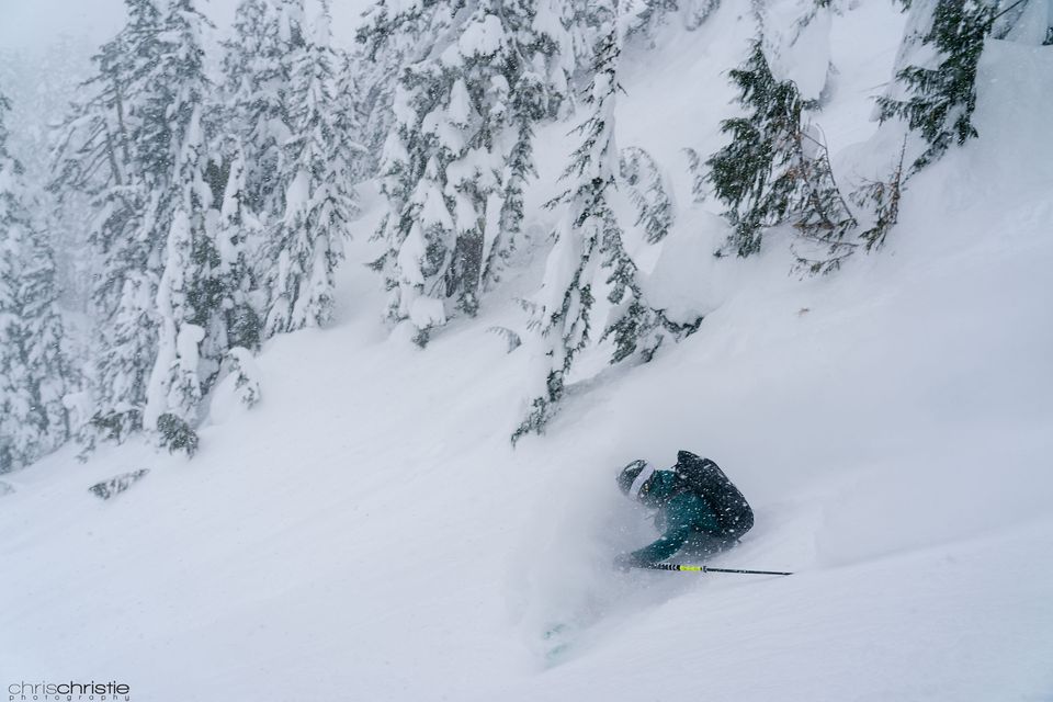
Powder! It’s been deep. REALLY deep! Trail breaking has been the biggest challenge and kept us from going very far!
Where we’ve been skiing:
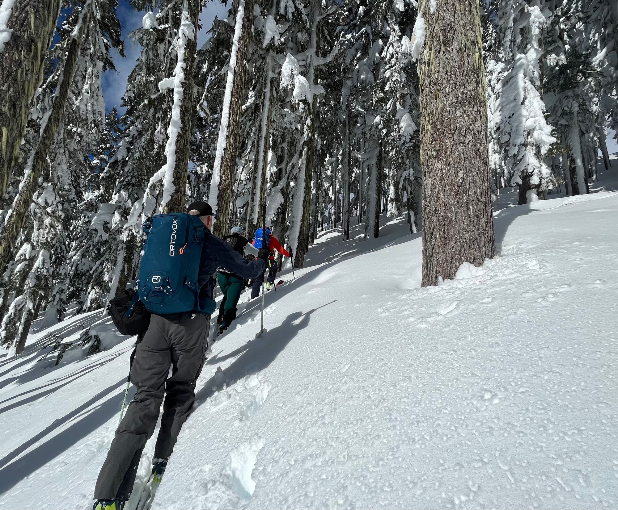
At the start of the week, we discussed where we’d most like to ski the upcoming storm. Evan wisely reminded Eric that you don’t leave powder for powder. As we both live in Squamish, we’ve both skied Squamish powder all week! This has been one of those nice periods (for us) where the North Shore gets a bit shafted with wetter elephant snot, while further north gets lower snow totals, all while Squamish gets nailed with snowfall! So, we’ve stayed local. That’s not to say there hasn’t been a few days of great skiing on the Shore or in Pemby though!
What’s happened since the last update (weather & general snowpack structure):
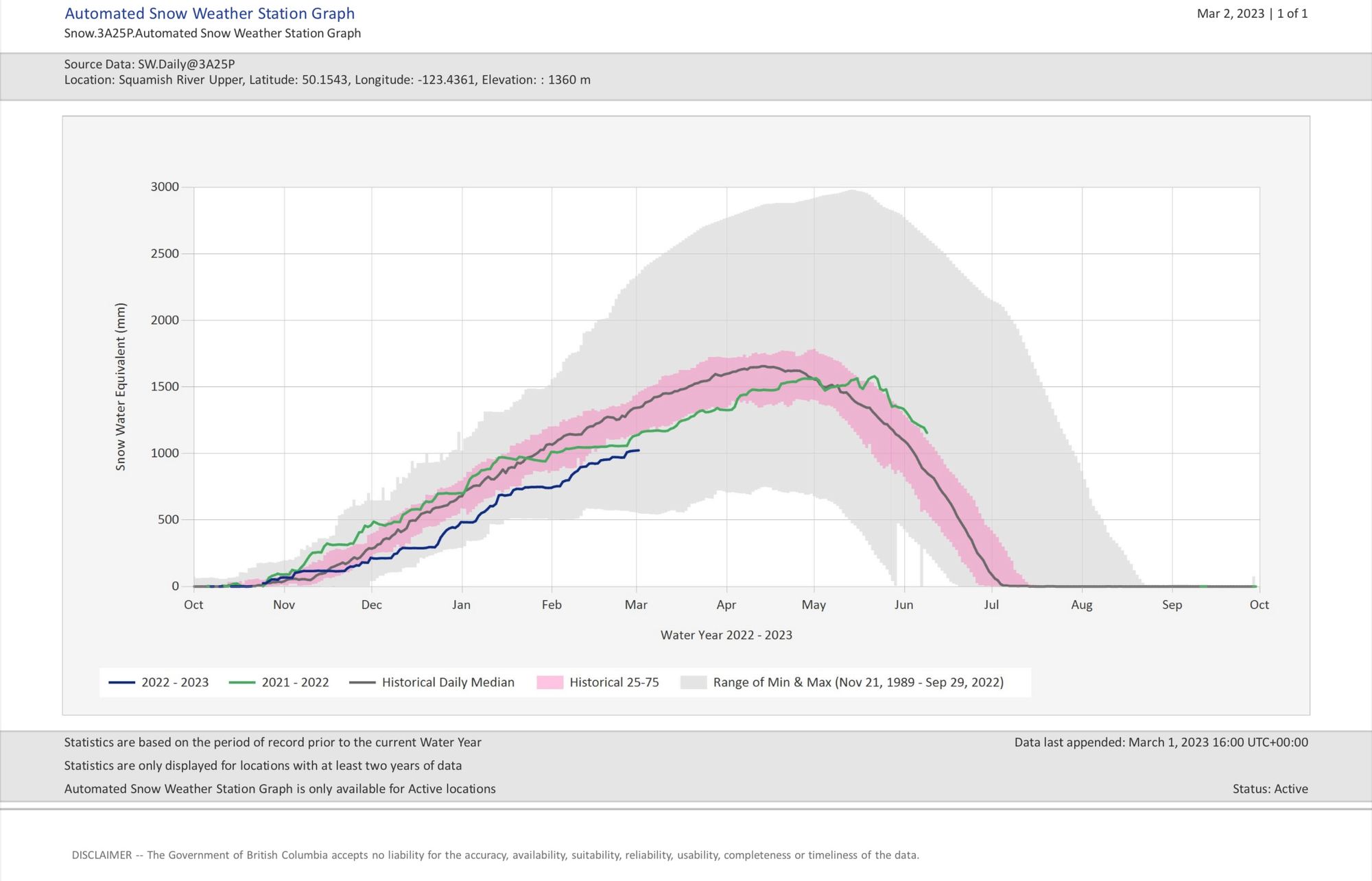
- Breaking the S2S into zones, the North Shore and Squamish have seen the most precip since last weekend (Saturday night was the start of the storm) with storm totals of ~70-130cm! Depending on how close to the ocean you are, this may have fallen as decent pow or pretty heavy and wet. This appears to be glued pretty well to the previous wind scoured/wind slab that developed during the outflow period last week.
- In the Whistler area, storm totals are more like 40-70cm but not quite as heavy. This snow sits over a pair of crust/facet layers we talked about in previous updates. It remains to be seen if these are currently reactive with the big snow load that was added this week.
- North and East of Pemberton, totals are more like 30-50cm. The new snow here may be stuck on pretty well to older fresh snow or to a crust layer that developed in last week’s cold snap.
All of these regions currently have storm slab as the primary hazard and this will likely continue until new snow stops falling!
What’s the weather and avalanche forecast?
For the moment, we’re looking at a continuation of the weather pattern we have. Predicted snowfall amounts aren’t quite as high as this week has been but still 10-15cm on Friday and then a trickle on Sat/Sun and potentially into the week! This is thanks to a cold front and then cold and unstable air mass that will park over BC.
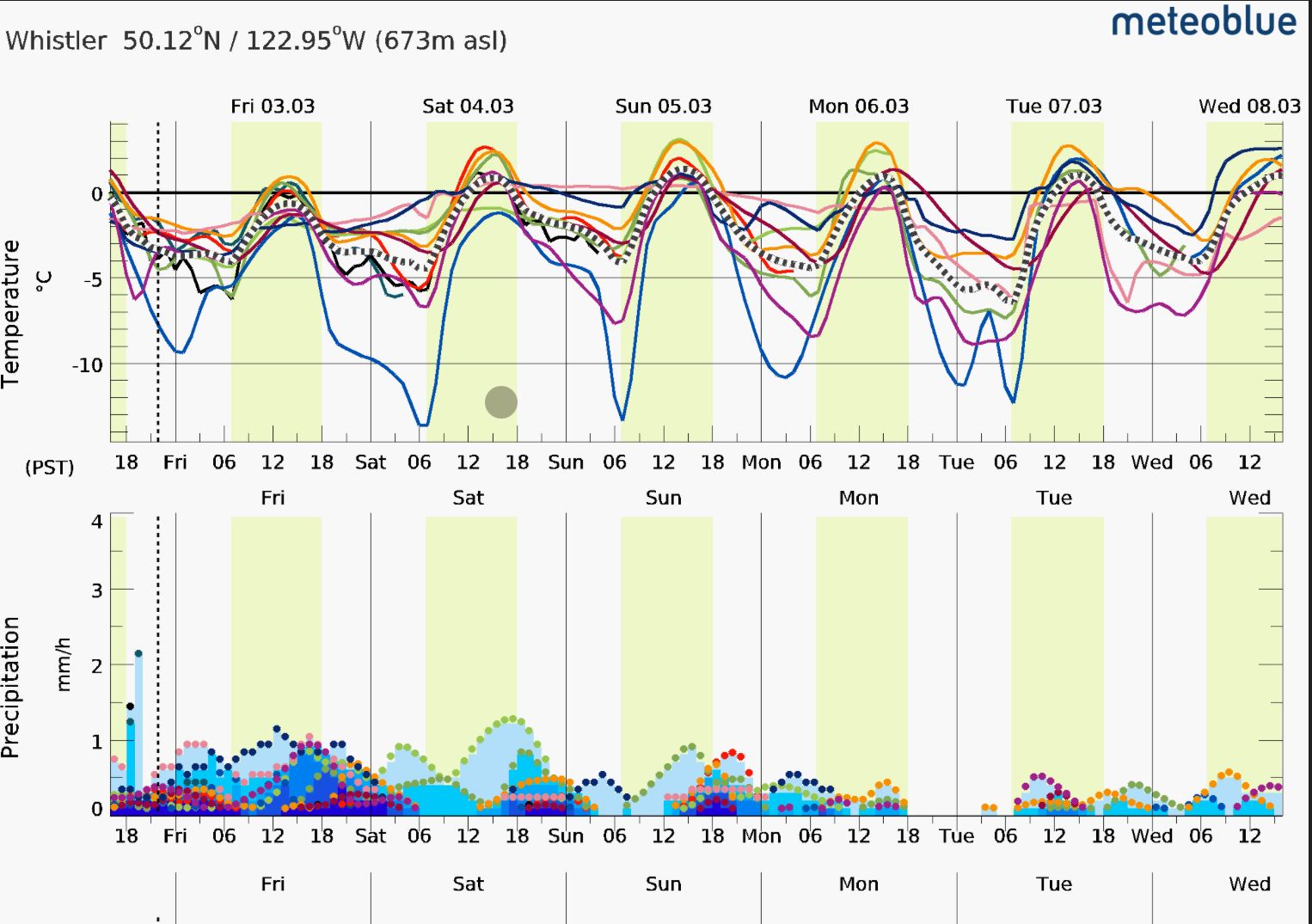
The avalanche forecast shows a considerable hazard through the forecast period with Storm Slab as the common primary problem. This is likely because of the continued incoming snow - makes sense! All this cold dry snow is prime to be moved around by the wind so if we see more wind, we could see a wind slab problem develop as well!
What are my questions for the weekend?
According to our survey - this is one of the most critical sections of our update so we want to make sure it’s detailed! Give us some feedback on the survey if you can!
- We were previously worried about last week’s wind slab problem becoming hidden by the new snow and surprising us. It turns out, this wasn’t as much of a problem as the new load was huge with relatively heavy snow, so for the most part the old buried wind slabs stopped being a problem and new storm slab development took over!
- What is the wind slab situation in the alpine? Alpine observations have been pretty limited this week. Heli companies haven’t done as much flying, and tourers haven’t gotten super high. We’re operating a lot off the weather telemetry for info here. The big question is, has the wind created new wind slabs with this storm snow? The few reports we have seen indicate yes! We’ll continue to watch wind numbers in places like the Duffey to decide if this will be a problem. Hopefully, it will settle out quickly with the warm days and cold nights.
- Could any of this step down to older weak layers (like our twin melt freeze crusts in the Whistler zone)? This remains to be seen! As we step out into the bigger terrain, this will be telling. Our guess is that in a lot of places, these layers are now sufficiently buried to be a non-issue but with the exception of very isolated features where not as much new snow accumulated on top - thin spots. This is precisely what makes this avalanche problem so tricky and scary! Avalanche Canada has a good write up for this on their blog!
- What avalanched in the last storm cycle? A lot of paths in Squamish slid on Sunday/Monday and again Wednesday/Thursday. It will be interesting to see what avalanched during these storm cycles as we move further north and to higher elevations.
What will I watch out for or avoid completely?
- With storm slab continuing to be an issue, as long as it keeps snowing, I’ll be pretty cautious about bigger terrain. The big storms seem to be done in the forecast but we’ll still be seeing a trickle of snow, and more convective snow that will keep the avalanche hazard higher.
- The sun is packing a punch! As the storms clear and snow tapers off, the sun will pop and that will destabilize things for a little while. I wouldn’t want to be in big south facing terrain when the sun comes out hard for the first time this week!
- Wind! If it gets (or continues to be) windy, this light new snow is prime for moving into wind slab.
Closing thoughts:
Things may seem simple and hopefully they trend that direction but judging the stability of these new storm and wind slabs is still tricky. I’m optimistic that as the snow tapers off early to mid-week, we’ll see improvements in stability but it’s not a given. For the weekend, we’re going to be stepping out pretty cautiously as things settle - there’s no rush. It will be super useful to understand what these massive new loads did to smaller terrain before we sample anything bigger.
We’ll be looking at near-tree line terrain that is relatively sheltered, and hopefully not a solar aspect that has seen much sun affect. As the cold temps wear off and things get warmer, we’ll likely be pushing further north in the zone to find good preserved snow until the surface resets and becomes supportive and chalky or new snowfall.
As always, we appreciate you reading this report! We want to spread the word to as many folks as possible so we can all stay safe, and ski great snow.
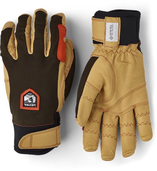
We primarily rely on word of mouth to get this information out there! To help spread the word, one of our partners, Hestra Gloves, is giving away a pair of Evan and Eric’s favorite touring gloves, the Ergo Grip Active! To enter, we ask that you forward this to a friend or a touring partner who might not have seen it!
If they sign up this week (before Mar 8), they’ll get an entry in the draw. If you upgrade your subscription to support us (by logging into the website), you’ll be entered too! Happy skiing this week and enjoy the pow!
Member discussion