
Mar 23 - Sea to Sky Snow Conditions
Overall theme:
Open Season! We saw this coming while writing the previous newsletter and were not disappointed. Conditions have been really manageable with minimal new snow and wind calming down.
Where we’ve been skiing:
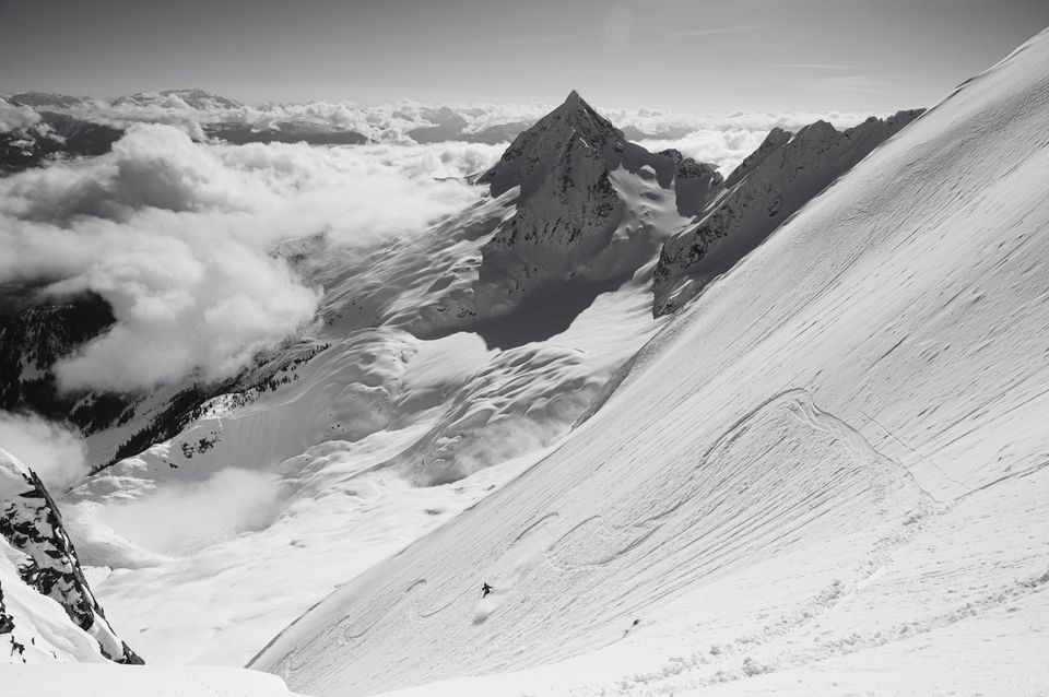
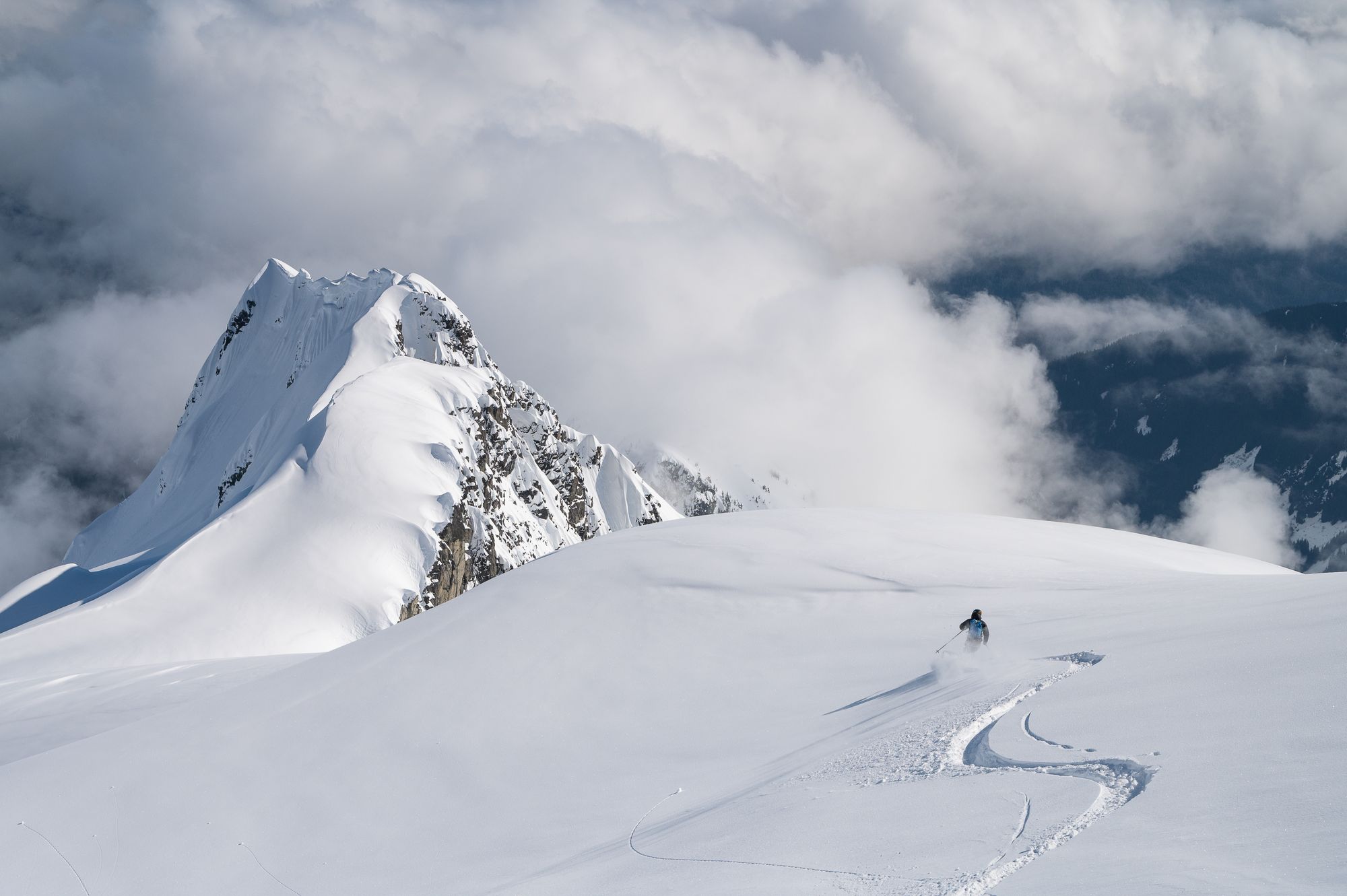
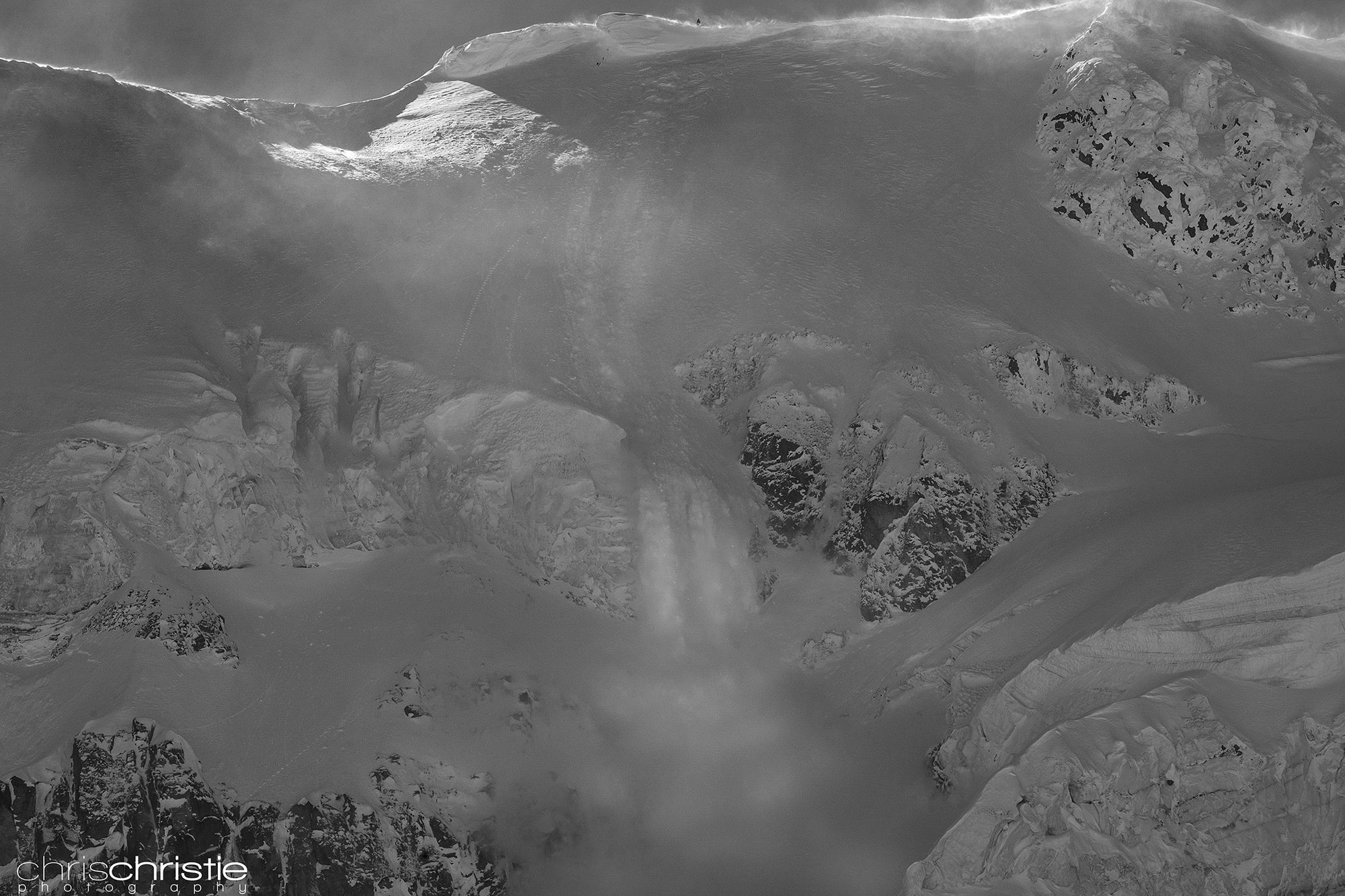
Largely we’ve taken advantage of these conditions to get into bigger steep terrain on Nch’Kay, in the Tantalus, the Wedgemount Group, and on Mt. Currie. In general we’ve found that steep lines with big cornices were generally a bit bombed out as those cornices have started failing. Lines without cornice overhead have held much better snow! East facing aspects at mid-elevation have started developing a melt freeze crust while west facing aspects are firmer and more wind affected. Luckily sheltered north aspects are holding pretty amazing powder still!
What’s happened since the last update (weather & general snowpack structure):
Mostly sun! Pattern shift from constant dirty convective showers to a more stable high pressure period. Not super high as we’ve seen a few pulses of precip, and temps have remained seasonable, but the sun has been out!
Most surfaces have started to experience some form of melt-freeze cycle. The sun is a lot higher in the sky this time of year and all but the most sheltered north aspects are getting kissed at sun point. This has a dramatic effect on ski quality. Due south aspects are developing strong crusts. East and west aspects might be developing thinner crusts or at least becoming extremely well settled. North aspects are holding powder well but are settling very quickly with warm temperatures during the day and clear cold nights that pull the moisture out of the surface snow!
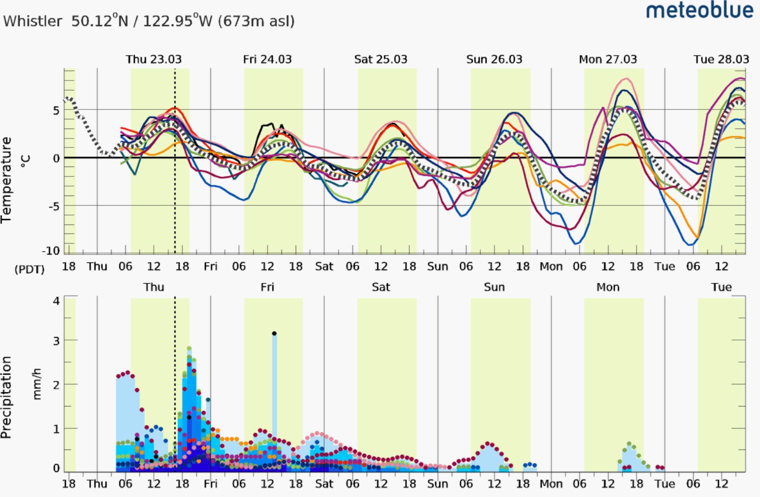
This shifted again as of Thursday with an incoming cold front that brought new flurries.
What’s the weather and avalanche forecast?
Flurries strongest Friday, tapering off through the weekend with high pressure back by Sunday. Expect a bit more precip closer to the ocean and a bit less on the Duffey. Avalanche Canada has the hazard increased on Friday but tapering down over the remainder of the weekend, especially further north where precip totals are lower and temperatures are colder.
What are my questions for the weekend?
- Will we get more than 10-15cm of new snow that could cause windslab development? A bit of new snow is a great refresh on surface conditions but lots of new snow brings the normal storm/windslab problem and a reason to step back.
- Will the warmth and sun negatively affect ski quality on north faces? It’s getting quite warm already and while our snowpack will continue to grow for a bit, things are shifting. Hopefully ski quality stays decent for powder snow a few more weeks!
What will I watch out for or avoid completely?
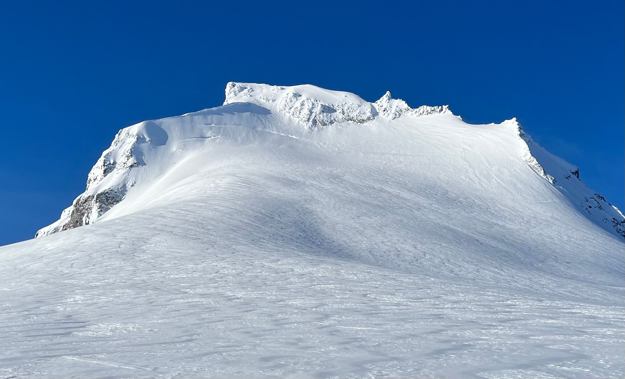
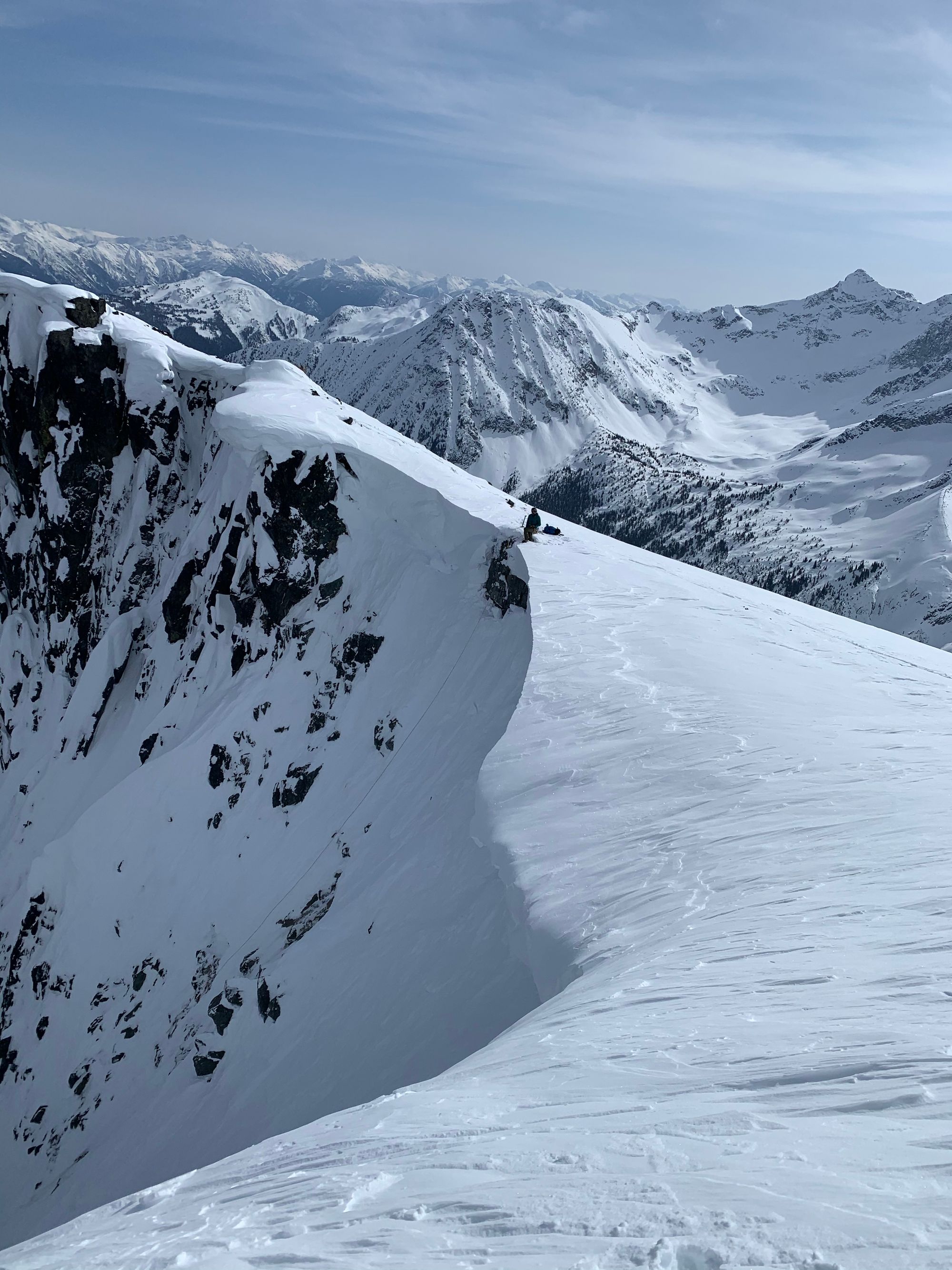
- Cornices! Cornices are popping hard. Separately we each triggered school-bus sized cornices while accessing descents. I certainly wouldn’t be booting up anything with any substantial cornice this week. Move fast and find better ways to the top!
- Bergshrunds and crevasses. Shrunds are starting to open up and I’ve seen a handful of crevasses in unexpected places. Watch carefully for sags and openings on glaciers and use the rope if you have any suspicions!
- Solar aspects late in the day, especially at and below tree line. Should be pretty straight forward, especially when we have wet loose as the primary avalanche problem but you’re probably not going to find great skiing here anyway!
- Lines that have been bombed by cornices or debris. Anything developing a runnel. (My goal is to find the best possible skiing at any point of the season).
Closing Thoughts:
You may have noticed in this newsletter (and perhaps the last one or two), there’s been a bit of a shift about how we’re talking about the snowpack. In January, there was a lot of discussion around “layers of concern” and how we might interact with (trigger) those layers. This newsletter we’re talking a lot more about the surface condition of the snowpack. It’s not that those layers are gone though. While it’s certainly possible that they’ve broken down or rounded to some degree, it’s more likely they remain weak but the bridging effect of the upper snowpack is strong enough to prevent those from being triggered and propagating.
Where this becomes important is when it becomes so warm that the upper snowpack is completely destabilized and the entire thing can fail on a weak layer. Especially when that weak layer is near the base of the snowpack (a deep persistent weak layer). We haven’t had a massive unseasonal heat wave yet, as well as no big rain on snow events. These two things are always huge indicators of big changes that the snowpack does not like. The sagging crevasse bridges and extra weak cornices are signs of basal facets lingering in the snowpack.
We’re also getting into the time of year where ski crampons are a prudent item to pack and boot crampons/ice axe can be a huge benefit. Firm snow can be pretty scary when you slip and slide, even when it’s pretty low-angle. A few accidents in the corridor have reinforced that sticking to terrain that is within our skill set is really important!
Also you have almost certainly heard but Black Diamond has issued another beacon recall (for their Recon LT model). It hopefully doesn’t need to be said but if you’re still running a BD or Pieps beacon, send it back and pick up a Barryvox from Mammut!

Got feedback or questions for us? We’d love to hear it. Jump over to our feedback survey HERE.
Eric Carter and Evan Stevens contributed to this report. For more information, check out Zenith Mountain Guides and our local avalanche forecast. This update is supported by SkiUphill Squamish - the best stop for ski touring equipment in the Coast Mountains!
Use this information at your own risk! We are not responsible for your actions in the backcountry and things change rapidly from when this report was written!
Member discussion