
Mar 16 - Sea to Sky Snow Conditions
Overall theme:
High pressure has arrived in the corridor and it feels like game time! But the sun and daytime warming are a major factor that we need to be careful around.
Where we’ve been skiing:
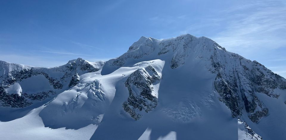
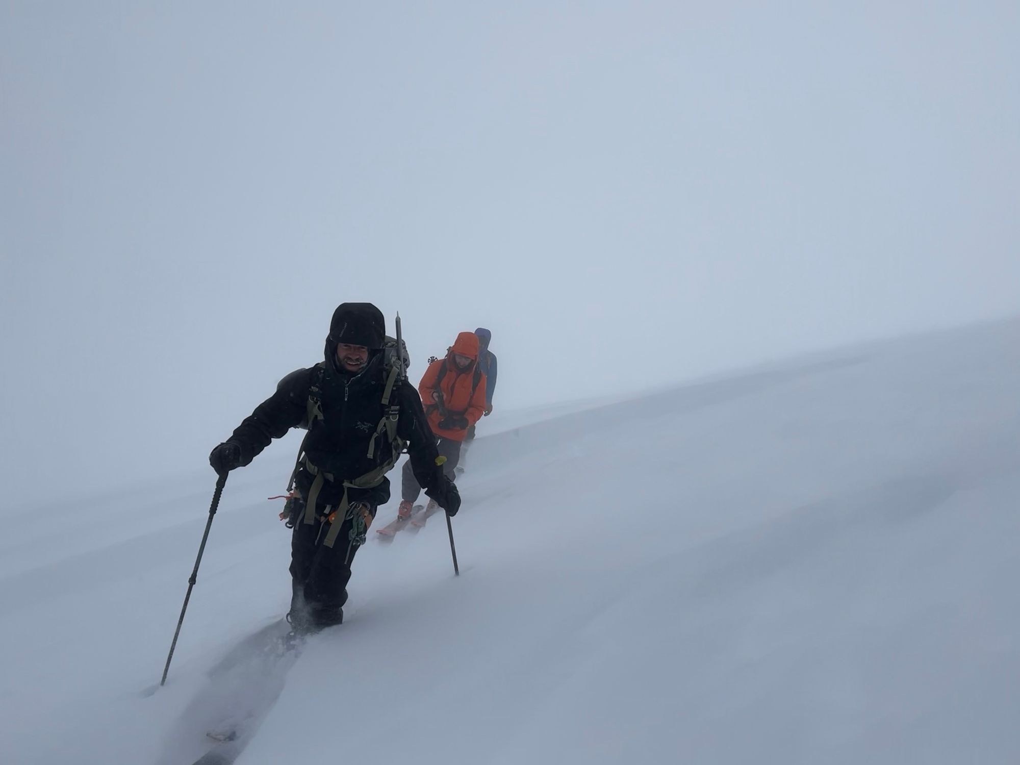
We started the week together at the Sea to Sky Gondola. We headed out to the Goat Ridge basin on Sunday morning hoping to get ahead of the incoming stormy weather. Surprisingly little snow had fallen at the gondola station but as soon as we climbed above 1200m, the new snow started to accumulate quickly. We headed for one of the main couloirs that we had climbed earlier in the week. The lower couloir had clearly flushed in the storm so we felt comfortable booting up. The steep walls were clearly sluffing extra new snow into the couloir and the storm slab development was noticeable as we reached the top. It was never cohesive and there were no other signs of instability other than the new snow. With visibility terrible, we opted to ski back down the line we had ascended. We did our best to stay in the runnel as we went down and Evan shot a great video of Eric cutting out a small storm slab midway down the line. This is a great example of how quickly these storm slabs can accumulate and seeing the debris that it collected was a good reminder that even small sluffs can pack a punch.
The same day, a group reported a surprisingly large avalanche near Co-Pilot, above the Stadium Glacier. This area sees a bit more wind and is certainly a funnel for new snow.
The rest of the week, we both spent time around Squamish (Mulligan and the S2SG) as well as the Whistler, Callaghan and the Currie areas finding great powder skiing.
Thursday was a change in weather pattern and also a day of stepping out for a lot of folks. A significant amount of terrain was skied in the Whistler backcountry. We were in the Wedge group on steep north facing terrain. With blue skies and sun it was a tempting day to get after it, though solar input was clearly having an impact on the snowpack!
What’s happened since the last update (weather & general snowpack structure):
The weather pattern this week totally resembles the previous week’s with smaller pulses of precipitation and wind but almost daily convective flurries that really stack up! It’s been incredible for building the snowpack, especially in the Whistler-Squamish region. It has however made getting into the alpine tricky with clouds and sometimes moderate-strong wind in the high mountains. The Duffey has had a little more sun and clear sky overall but can always get a decent amount of snow from these convective snow patterns, and it did! Luckily temperatures have remained low this week, in part thanks to the high clouds.
If you were out on one of the clearer days though, you may have noticed an interesting weather effect of these spring-like days. The warm temps causes clouds to form around tree-line. These are thin, low lying clouds and often you can see the sun softly through them. This creates a greenhouse effect where temperatures within the cloud rise compared to the clear air above or in the valley. Riding the chairlift you end up going from cold to warm to cold!
These ongoing flurries of varying intensity continue to add snow to our generally well consolidated snowpack. The new snow was certainly a bit heavier on the North Shore but otherwise it’s falling and settling quickly. The main layers of concern in the lower snowpack are further north in the Pemberton/Duffey region where a deep persistent weak layer will be an issue going into spring and have started to slowly wake up in the drier/shallower regions with the wind, sun and new snow.
Any sun affected aspect will have some sandwich of melt-freeze crust below and between the new snow. These will also develop new crusts in the sunny weather very quickly. Several avalanches were reported in the Whistler area on Sunday but we haven’t seen many details. I would be curious if these were windslab near ridge crest or on solar aspects.
Thursday saw lots of reports of solar or cornice triggered avalanches in the size 1-2 range throughout the corridor, including women skier triggered slides in the poop chutes that you might have seen as you exited out of your Blackcomb backcountry day. Solar aspects will certainly soften during the day, but the avalanche danger will rise to considerable on those aspects every day the sun comes out, so plan/time your days accordingly.
What’s the weather and avalanche forecast?
Thursday brought an exciting change in our weather pattern and we are into high pressure that looks like it will last through the weekend. Just a few high clouds on Thursday allowed the sun to punch through and have a fairly significant impact on the snowpack. This is reflected in the AvCan forecasts for Friday/Saturday in the Whistler and Duffey regions that have alpine conditions listed as Considerable.
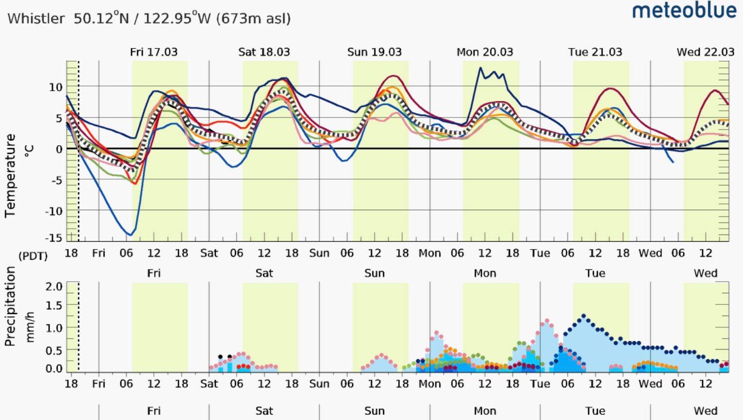
It looks like a chance of a weather system coming in. It was originally forecast for Sunday but now appears to be pushed back to Monday. That’s pretty far out for a reliable forecast so I’d say it remains to be seen how long this high pressure will last.
Overall, expect each successive day to see higher freezing levels and more input from the sun. As each day goes by, I’ll be looking to finish earlier in the day and avoid south facing terrain as much as possible. Seek shaded, sheltered snow and avoid spending time under cornices!
What are my questions for the weekend?
- How warm will it get? And what impact will that have on the snowpack? Will we see bigger avalanches as a result of the solar input?
- Will there be new snow later in the weekend? Will we go back to the convective pattern or break into continued high pressure?
What will I watch out for or avoid completely?
- South facing (solar) slopes, especially at low altitude. This should be pretty clear as we’ve been talking about it the entire newsletter. We’ve got a winter snowpack and a lot of sun on it. That’s not great and should be avoided!
- Corniced north (or any) slopes. I noticed two big lines that were boot packed in the Wedge group on Thursday. Both lines have mega-cornices and can also be approached from the top-down. You couldn’t pay me to climb these lines right now.
- Anything with sun late in the day. These can be a surprise scare if sun hits something later in the day, especially if it causes something like a cornice release.
- I will definitely still keep wind slab in the back of my mind even if sun related stuff is what I’m mostly thinking about!
Closing Thoughts:
It feels like it’s time to get rad in the mountains anytime blue sky and high pressure comes but this is a major change for our snowpack so we need to be cautious any time the sun gets involved. Watch out for overhead hazard. We’re also getting into ski crampon season! Any slope that gets the sun will start developing a melt-freeze surface crust and might be a hassle in the morning before it warms up!
With sun and rising freezing levels as our biggest concerns, use a map app to look at aspect shading and elevation bands to determine how big a factor this might be in your tour. We use Fatmap because you can create custom layers that take both factors into account to visualize slopes to avoid!
Eric Carter and Evan Stevens contributed to this report. For more information, check out Zenith Mountain Guides and our local avalanche forecast. This update is supported by SkiUphill Squamish - the best stop for ski touring equipment in the Coast Mountains!
Use this information at your own risk! We are not responsible for your actions in the backcountry and things change rapidly from when this report was written!
Member discussion