
Feb 16 Sea to Sky Snow Conditions
It’s the third edition of the newsletter! Is this info helping you out? Any feedback for us? We are keen to make this as useful as possible, so please let us know! And…if you like it, throw some support our way by bumping your subscription to a paid option - it’s just $5 per week! Head to the main site here and sign into your account (or create one if you haven’t already) and you can increase your subscription from there.
Eric and I are professionals and we make our living gathering info like this and implementing it into our plans and decisions. Please feel free to keep using this info without any need to throw $$$ our way, but if you like it, toss us a cup of coffee!
Overall theme:
The big story this week is that we are finally settling into some quality midwinter-like skiing. However, it’s a touch later in the year, so the sun is starting to pack a punch and intermittent crusts on solar aspects have started to (and will continue to) be a factor from here on out. The other big theme in the set up this week was the wind.
General snowpack structure:
10-20cms of light fluff in most places in the corridor now sits on top of either a suncrust/old settling wind slab in upper treeline and alpine exposed locations, or maybe even a small surface hoar layer in sheltered spots.
This new snow is (currently) falling with minimal wind and some cold temps with low freezing levels. A very good combination for ski quality. And despite the lingering snow showers through the forecast, it is a W-NW atmospheric flow which means it won’t be as foggy/claggy out there.
There are still some lingering, low likelihood/high consequence deep persistent slabs slumbering along. There have been occasional reports of the shallow rocky/thick to thin snowpack locations popping out weird slabs - so we still don’t have complete confidence on lots of terrain, but we are seeking to have some positive test results in specific locations before committing to features. Think large cornice bombs, specific snowpack tests, etc…
Closer to the coast we still had a few deep, worrisome slabs pull out on some buried melt freeze layers (Chocolate Bowl, Squamish Valley). So again, suspecting most slopes until they prove to us otherwise that they don’t want to kill us.
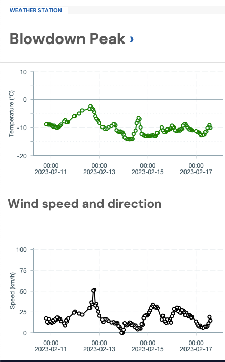
Lots of the high alpine got hit by some winds in the early/middle of the week. The good news is that most of those slabs are settling out and tightening up, but the bad news is that they are not going to be as obvious as they get covered with light new snow.
Where we’ve been skiing:
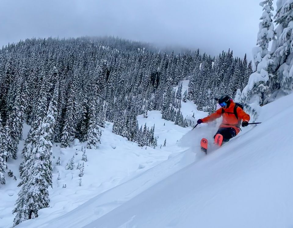
- Paul Ridge/Squamish has maintained some good snow quality and is only getting better with the continued low freezing levels. It survived the Sunday warm-up well, with breakable rain crusts settling fast and new snow stacking up on top.
- The Duffey seemed to get less wind overall compared to the Whistler region. We found excellent skiing on the North Face of Taylor on the weekend and reports continue to be quite good!
- Rutherford ranges/Hurley/Upper Pemberton Meadows. Got hammered with 40+ of new snow this last week, but also some wind. If you could avoid the wind exposed locations you were rewarded with deep cold smoke. If you found the wind, you also found some fresh wind slabs.
- Whistler and Wedgemount zone got wind and less snow as well. Good at treeline but wind affected up high!
- South of Hope/near Manning Park, saw snow early in the week and winds continuing through Thursday. Small avalanche cycle in steep terrain and due to cornice failure.
What’s happened since the last update (weather):
We did see the storm arrive on the weekend with some new snow that made for great skiing on Saturday but a somewhat unfortunate warm up throughout almost the entire corridor on Sunday. Luckily, by Monday night, weather returned to more seasonable with cooler temps and continued drips of snowfall throughout the week. As mentioned earlier, the first half of the week had wind in most places but that has tapered off towards the end of the week.
What’s the weather and avalanche forecast?
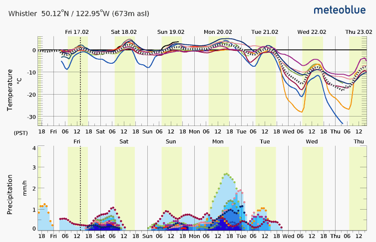
Colder W-NW flow, finally, with fluctuating estimates on how much snow and when. This should be consistent with the week we’ve had continuing through early next week: seasonable temps, occasional preip (but nothing mega), and a bit of wind.
We could see a good frontal passage on Tuesday bringing us some cold, clear weather. By mid-week, we’re hoping for this to arrive and to be looking at good alpine travel conditions!
Currently Avalanche Canada has the forecast at 2-2-1 in the Sea to Sky and 3-3-2 in the Duffey Inland, either staying similar or trending downward (improving) by the end of the weekend. In both areas, the avalanche problem is for windslab and a persistent slab with a difference in both chances of triggering and expected size of avalanche.
What are my questions for the weekend?
- Will the next few days bring us wind and more building of wind slabs or will we see wind taper off and stability improve with good ski conditions? At the moment, the wind doesn’t look too crazy!
- Will the load we’ve gotten the last couple days hide the wind slabs buried earlier in the week? Hopefully most of these have popped off already but I’ll be careful in consequential terrain for sure.
- Will we see clear/cold high-pressure arrive by mid-week?
What will I watch out for or avoid completely?
- Fresh/lingering wind slabs in exposed locations (and anywhere of consequence). This should be pretty obvious from reading this issue but it’s our primary concern at the moment!
- Sluffing in the steeps. New snow is good, cold snow that runs fast and heavy. Even if the slope is stable, when it’s steep, it’s easy to get smoked by a fast moving sluff.
- Shallow/rocky areas. This is a concern all season as far as we’re concerned. Thin snowpack means we need to be more careful around shallow spots.
- Buried melt freeze crust closer to the Coast. Especially on big open, convex slopes that may have seen extra wind loading. It seems generally these are causing avalanches in the corridor between Squamish and Whistler but that’s not exclusive. They have been almost everywhere. Clearly those PWLs exist in most places. It’s just a question of if they have a load to activate them.
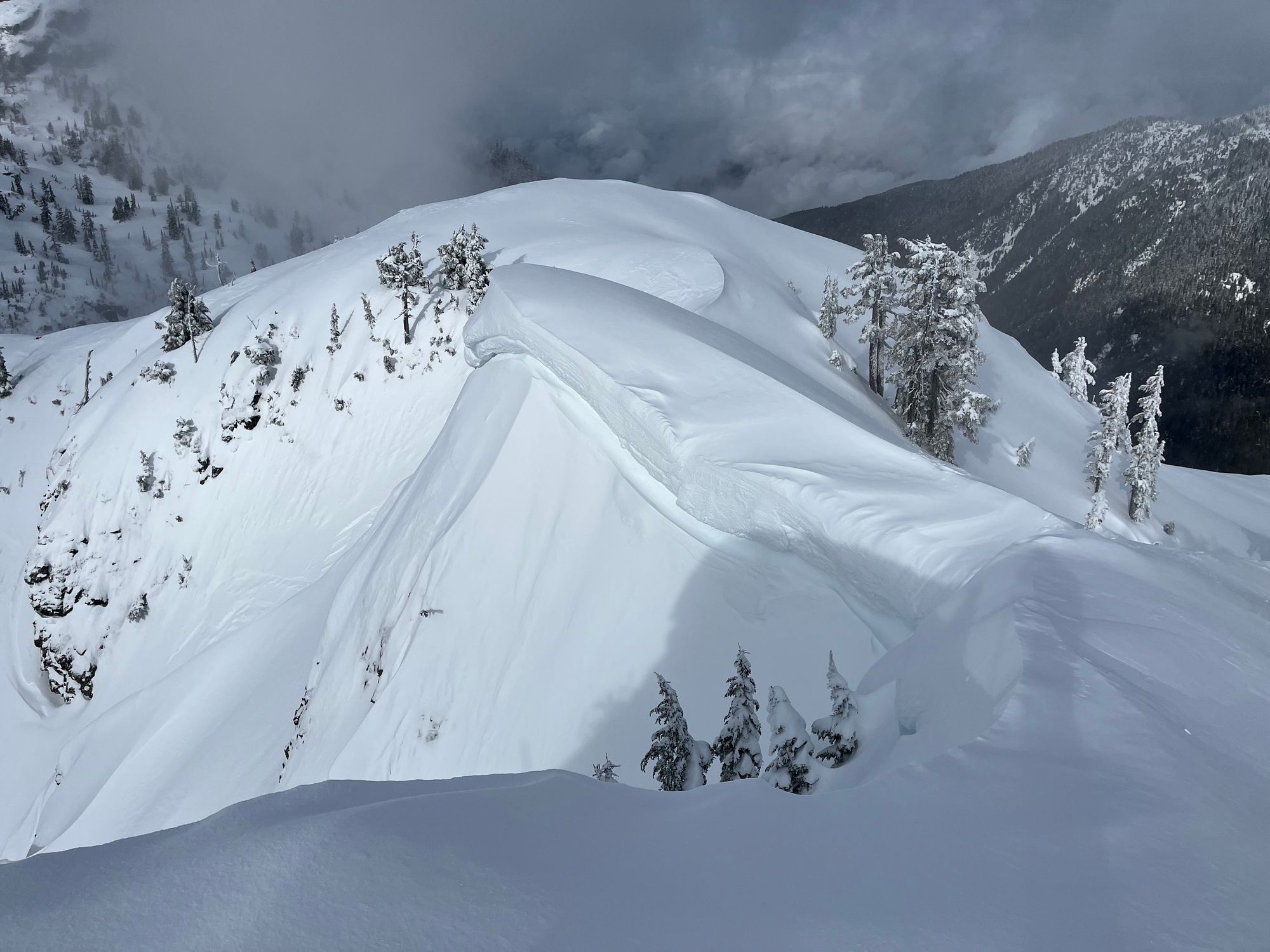
- Cornices! Cornices have been much smaller than normal this season but that is no longer the case. There has been plenty of new snow and wind for cornice building. We found the debris from a cornice that fell on Monday or Tuesday in the Wedgemount group that slide to Size 3. I’m not going to be booting up anything with a cornice from here on out.


An extra note:
WHAT is an area of consequence? Anywhere you could fall from, or fall into. An exposed face above a cliff has consequence. Any slope above a terrain trap has consequence.
Thanks for reading again this week! Don’t forget to give us some feedback! Leave a MIN report on Avalanche.ca if you get out!
Member discussion